Post #35: Commencement

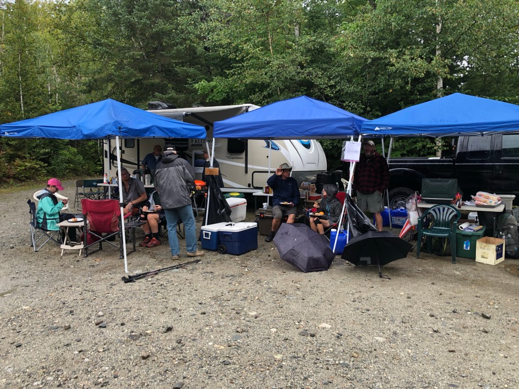
Shaw’s hostel in Monson, ME, is one of the most popular hostels on the AT. So I chose to spend September 9 there to find out what all the hullabaloo was about. Once again I was blessed to be indoors while two inches of rain fell during my 24 hour stay; that has happened several times during my trek. Shaw’s has a great food resupply and a small gear store carrying all the replacement gear a hiker may need. They offer delivery of a food resupply bucket to hikers in the Hundred Mile Wilderness (which I took advantage of), provide shuttle service, and serve a big hiker breakfast every morning at 7am.

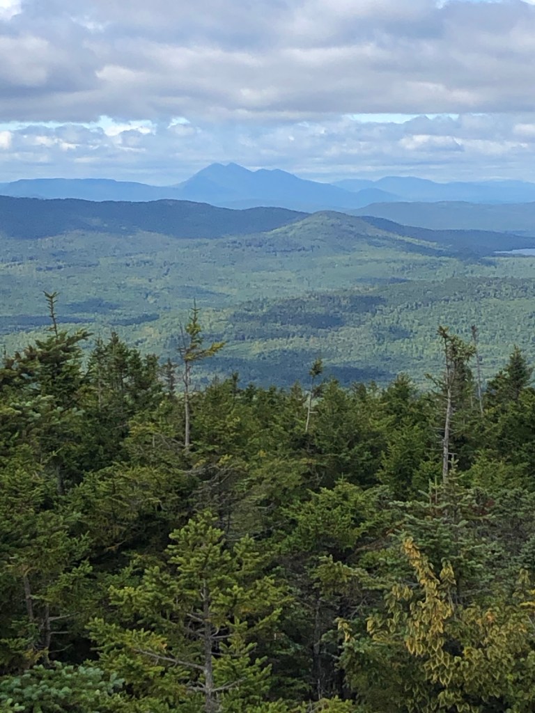
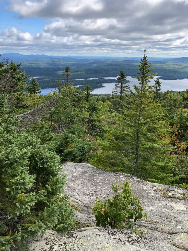
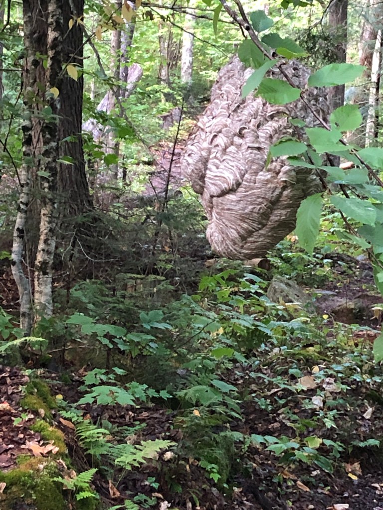
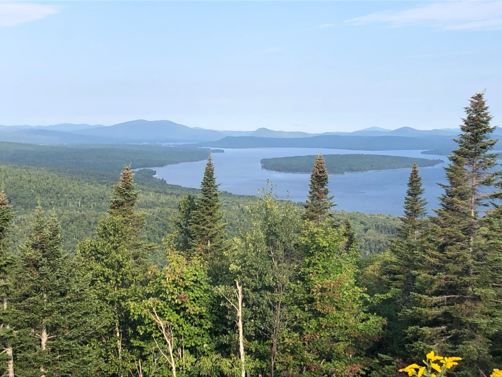
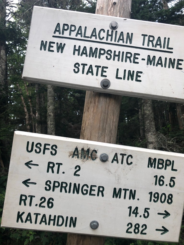
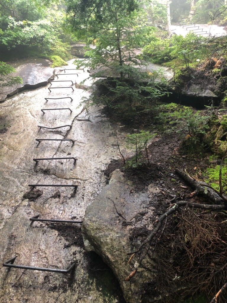
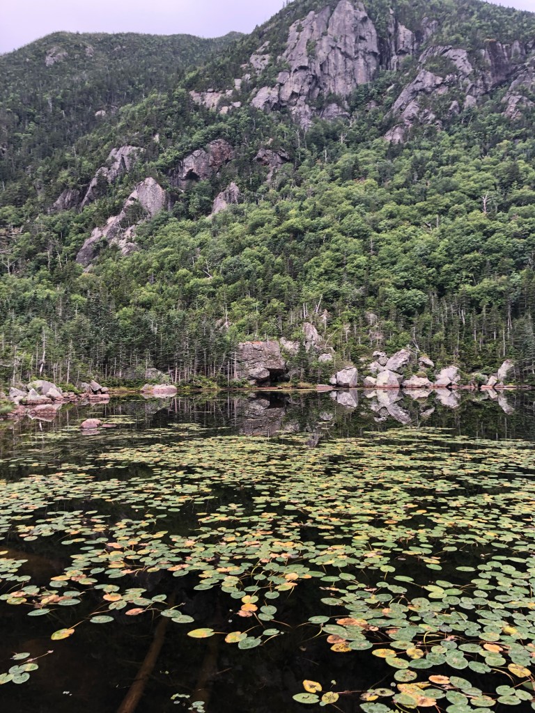
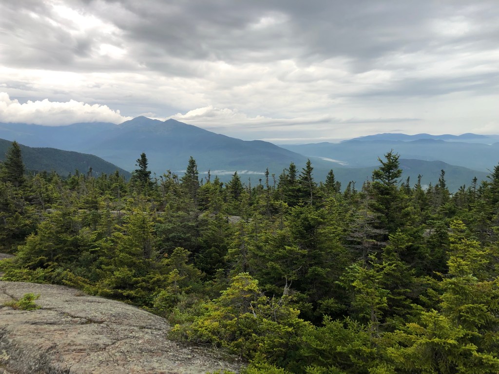
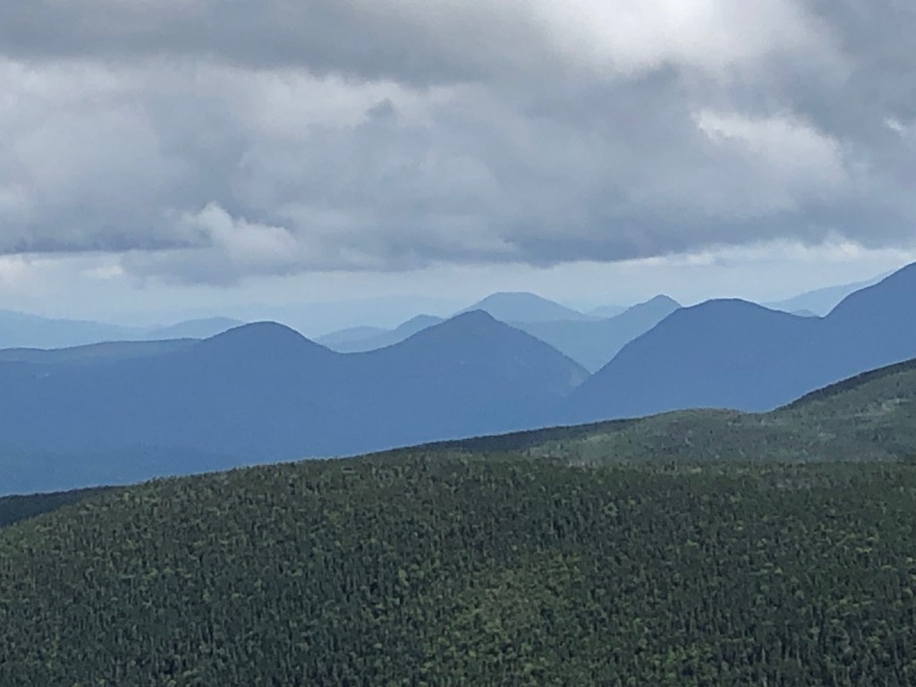
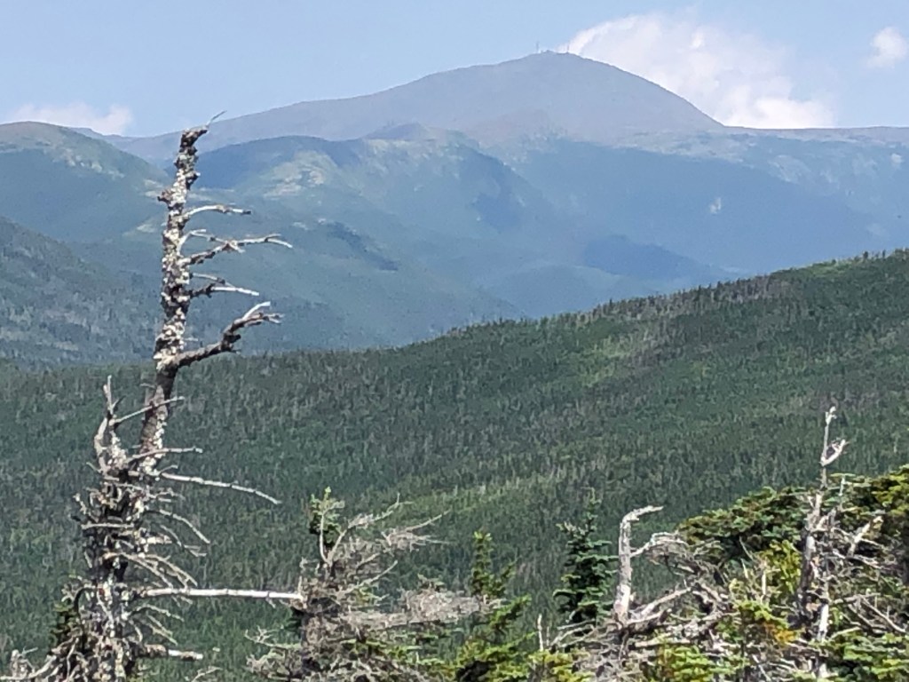
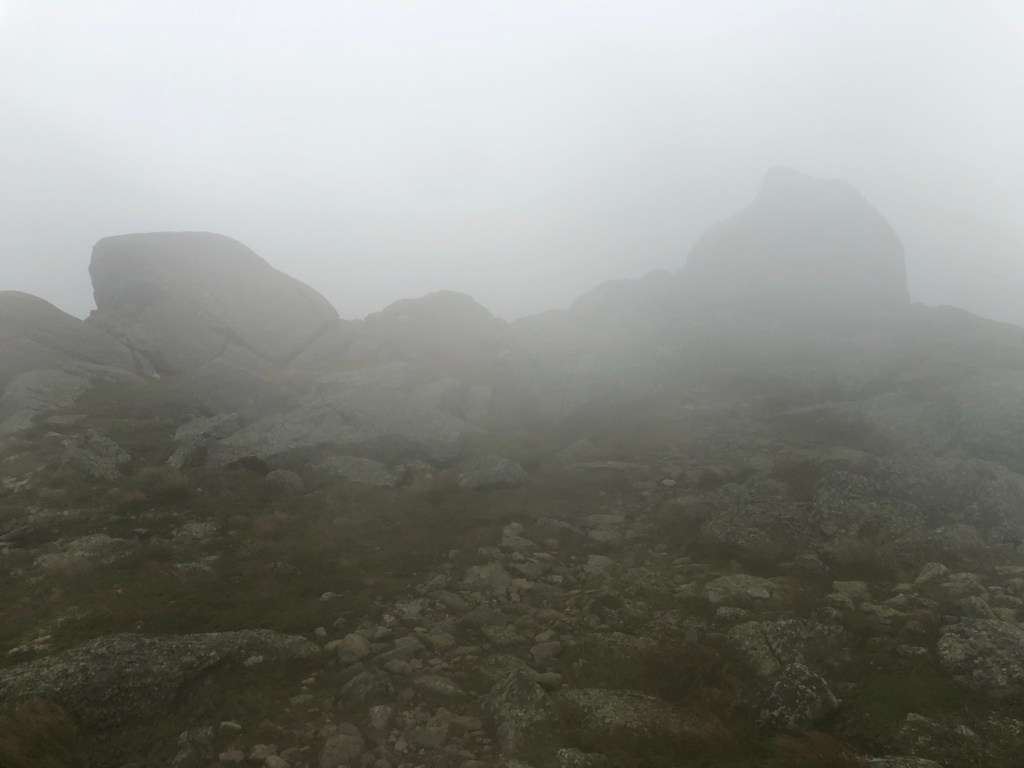
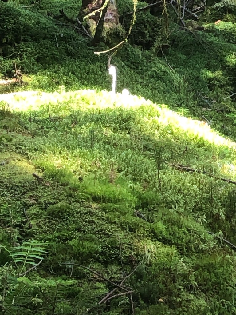
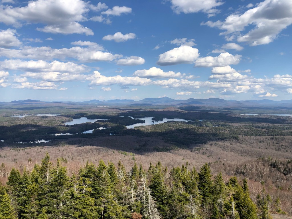
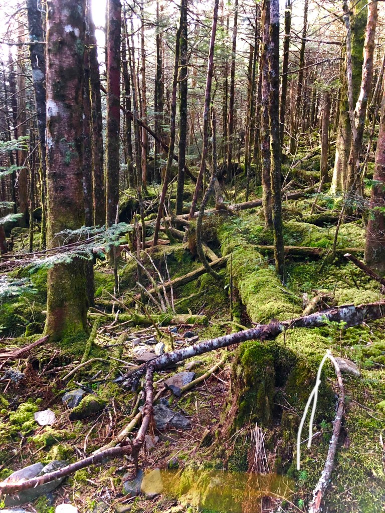
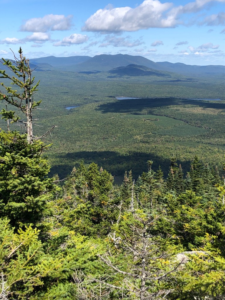
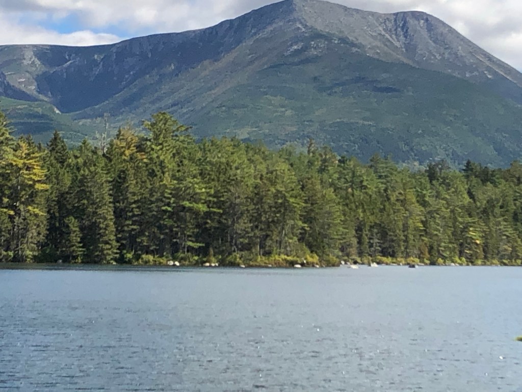
The Hundred Mile Wilderness isn’t what you may think. It is a hundred mile stretch of the AT where there are no paved roads or places to buy supplies or food. But this is not wilderness- areas where human impact is unnoticeable or limited. There are lots of private dirt logging roads and from the hilltops one can see many plots where trees have been harvested in the past ten years. The area includes many lakes, hiking, snowmobile, and ATV trails. Most of these private dirt roads are open to the public for a fee. Many of the isolated lakes have a cabin on their shores and when I listened carefully, I could hear the faint drone of a generator. Occasionally I could hear the rumble of a logging truck as it made its way along a gravel road.

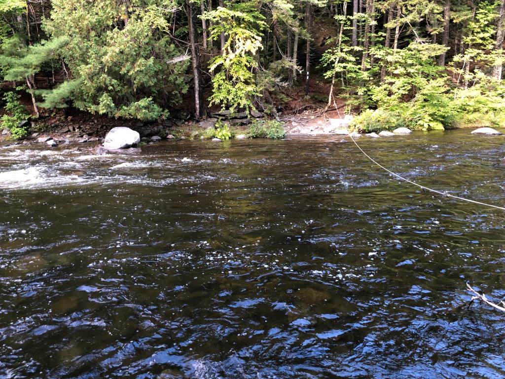
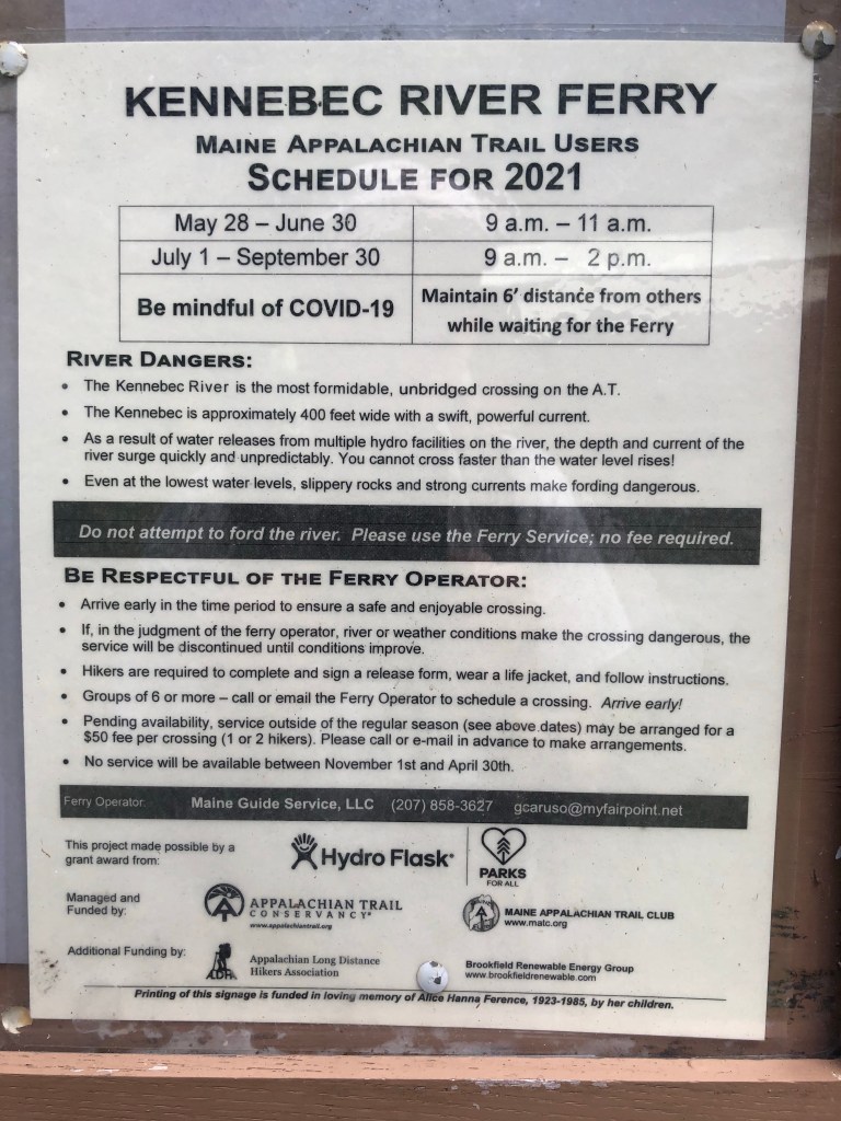
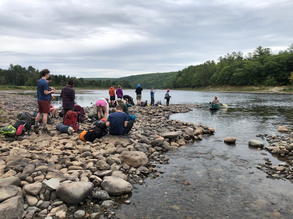
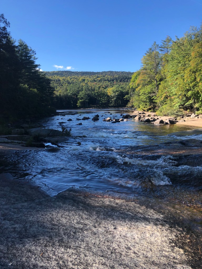
One of the things Maine is known for in the AT hiking community is the river fords. In other states, there are usually rustic bridges spanning rivers that the AT crosses; in Maine you are expected to wade across these rivers. I was thinking that I was missing out on the fords due to the drought western Maine is experiencing this year. Remember how I mentioned getting two inches of rain during my hostel visit? Well, you can imagine what that did to the river water levels.

Hornet nest guarding a ford

While hiking on the morning of the 10th, I met the Umberger family: Butterfly, her husband Bob, and six children ages 8-14, who were thru hiking.  I admitted that I envied them and wished I could have done a thru hike with my family; but my kids probably wouldn’t speak to me again, everyone would require years of therapy, and it likely would have cost me my marriage.

Later that day, I negotiated my first ford in thigh deep water with a strong current and slippery rocks.  And then I did it again when the Umberger family showed up and I realized that they would appreciate another grownup type person to help the kids.  Again I was reminded that this is all part of the adventure.

Sunday, September 12, was the easiest day of hiking that I’ve had this year and it wasn’t due to the terrain. It’s because I spent the day hiking with a couple around my age, known as Gone with the Wind: Rhett and Scarlet. They were a hoot and I was a fresh set of ears for Rhett. It was like listening to an audiobook and made the time pass so quickly. I wished I could have hiked with them for several days, but since they had to pick up their food resupply a day before me, Gone with the Wind had to hike some longer days to make that happen. I was blessed by the time I had with them.

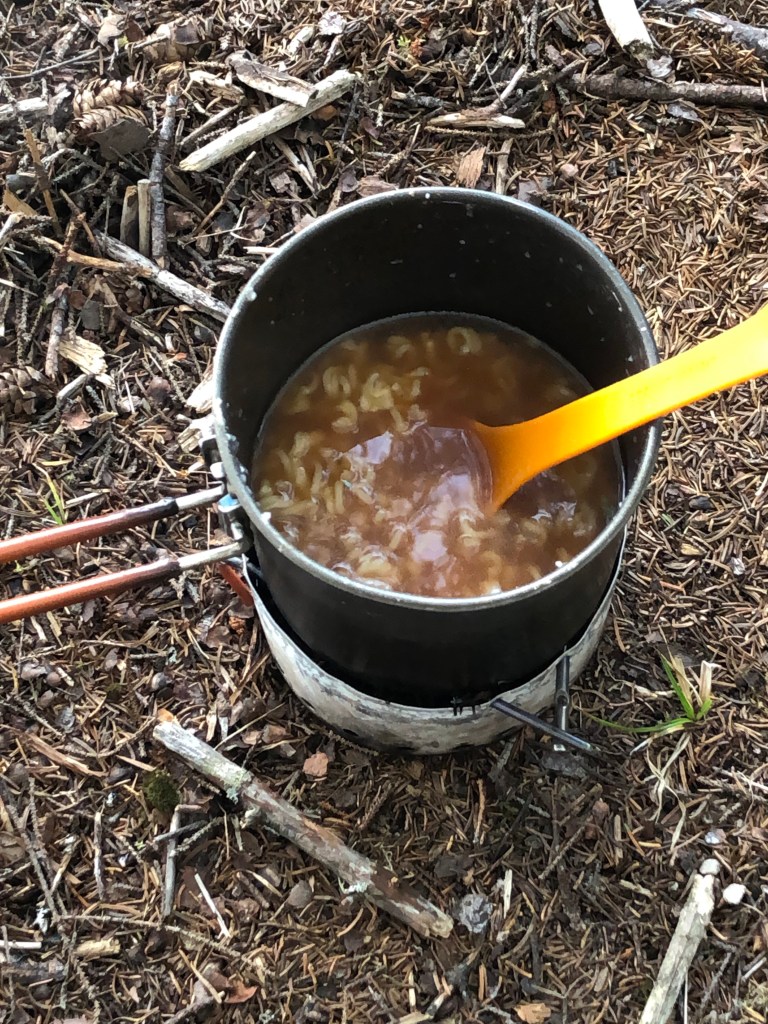
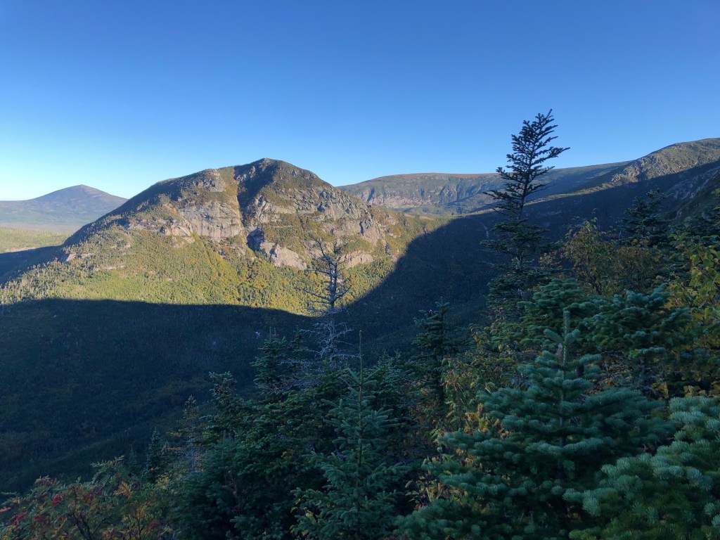
For me, one of the best things about thru hiking is not having a schedule to keep.  I often wouldn’t decide where I was going to spend the night until after lunch time.  It was so freeing not having a deadline.  But once I started the Hundred Mile Wilderness, I had a schedule: I had to be at the Johnson Pond road crossing at 3:00 on the 14th to pick up my resupply; I had to sign up for the thru hiker campsite in the early morning hours when I left the wilderness and entered Baxter Park- they only allow 12 thru hikers per day (Mount Katahdin is within that park and its peak is the northern terminus of the AT);  I had to coordinate my departure from Baxter Park so that I could get a ride home.  I think, like me, many thru hikers feel like their mindsets change once they enter the Hundred Mile Wilderness. With the end in sight , they now think of planes, trains, and buses to catch, in addition to new jobs that are waiting.  For some, there is a greater sense of urgency; for others, their final days are a time to slow down and savor the moment. The days of caring only about the next resupply, where the next water source is, and what flavor of Ramen to boil up are ending.

My mid-wilderness food drop resupply was a little different than I had hoped; I arrived at the designated site six hours early.  I was hoping that Shaw’s would have a morning drop scheduled for another hiker and I could get my food early, but they didn’t, so I waited.  An hour after I arrived, the Umberger family joined me and awaited their resupply that Butterfly’s mom was delivering.  It was a great opportunity to get to know them better.  After our resupplies, I spent the rest of the day hiking with them and that night camped with them.  I finally found someone I could keep up with: Abram, their eight year old.  

We spent the 15th hiking in the rain. My umbrella and my ears got quite a workout; the Umberger kids had a lot to tell me as we hiked. It was amazing how the kids never complained about the rain; they just took it all in stride. You can read about their AT adventure by googling Perch Creek Explorers.

Umbergers

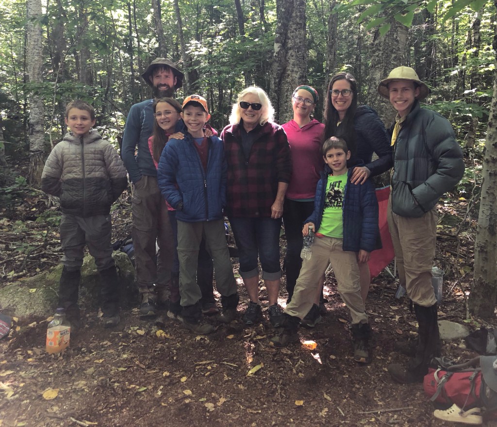
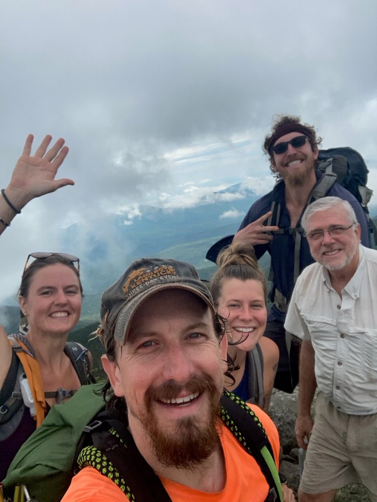
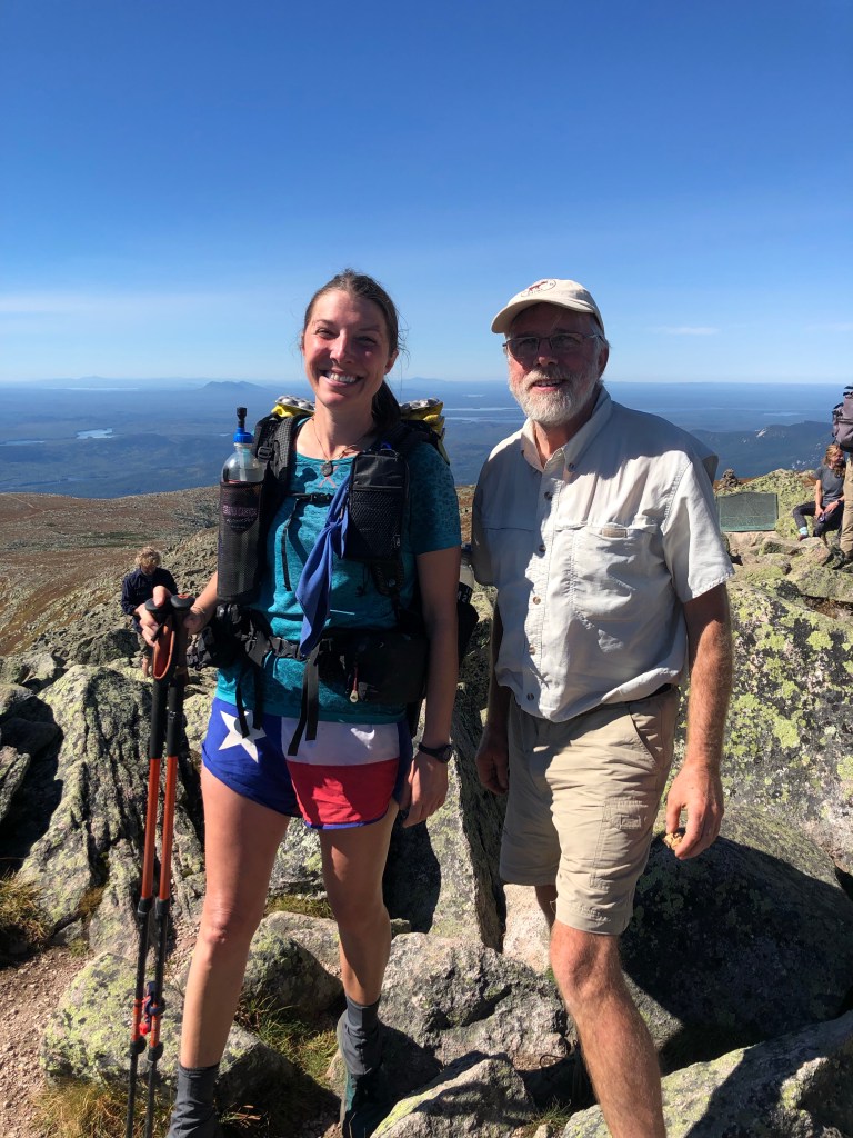
Although we often camped at different sites, I continued to see the Umbergers every day or two for a week. I accepted their invitation to join them at their reserved campsite in Baxter Park on the night of the 19th and summit Katahdin with them on the 20th.

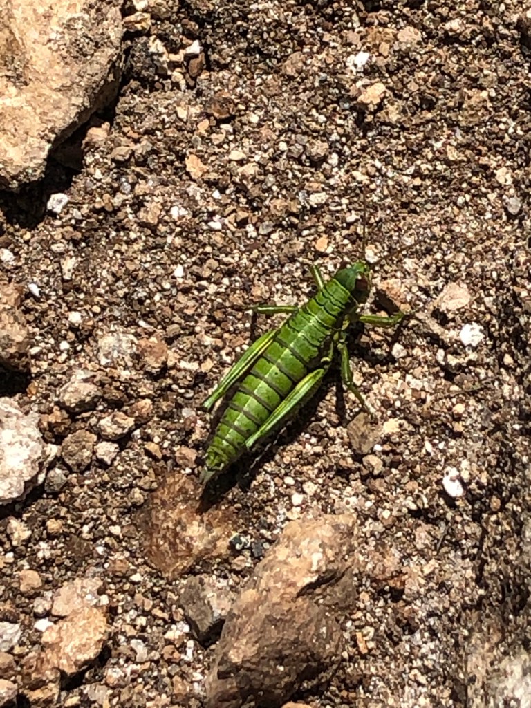
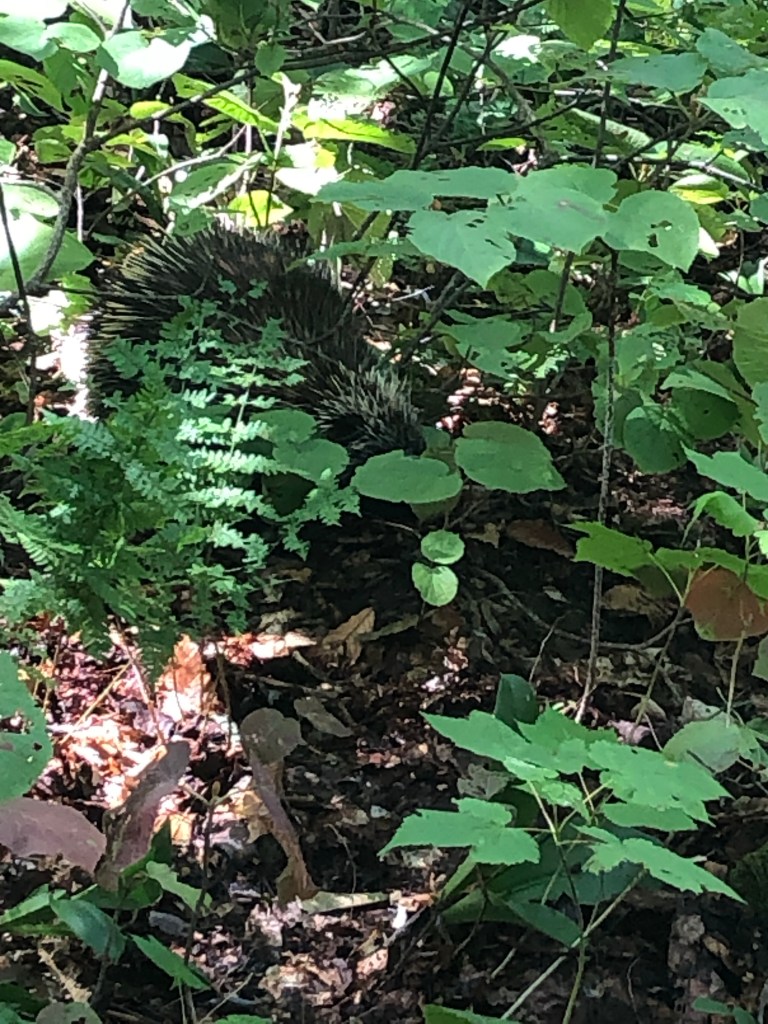
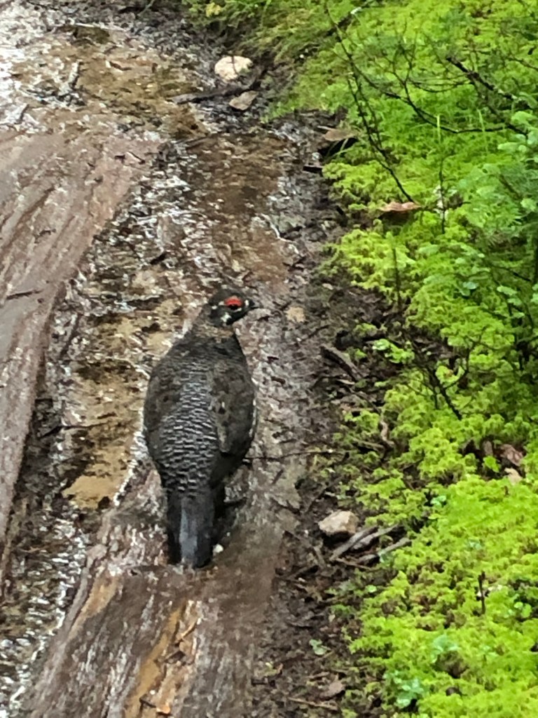
While hiking alone on the 17th, I rounded a bend in the trail.  Waddling toward me just 20’ away was a porcupine.  We both paused and for a moment made eye contact. It then scurried to the nearest tree it could climb while I fumbled around for my phone to take a photo.

I decided that the 20th would be my final day of hiking.  This afforded me the opportunity to have several shorter and easier days; I was finished by early afternoon on my final three days of this trek.

My arrival at the Abol Bridge campgrounds, just south of the Baxter Park boundary, marked the end of the Hundred Mile Wilderness. I was able to get a one day resupply, do my laundry, and take a shower at the private campground. While talking with a couple at Abol Pines campsite along the Penobscot River, we realized we had met before; at a McDonald’s in Gorham, NH, five weeks ago.

Evening along the Penebscot River

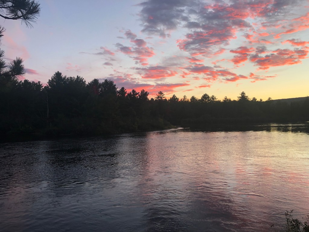
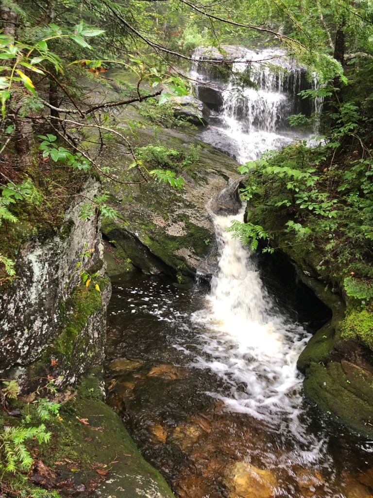
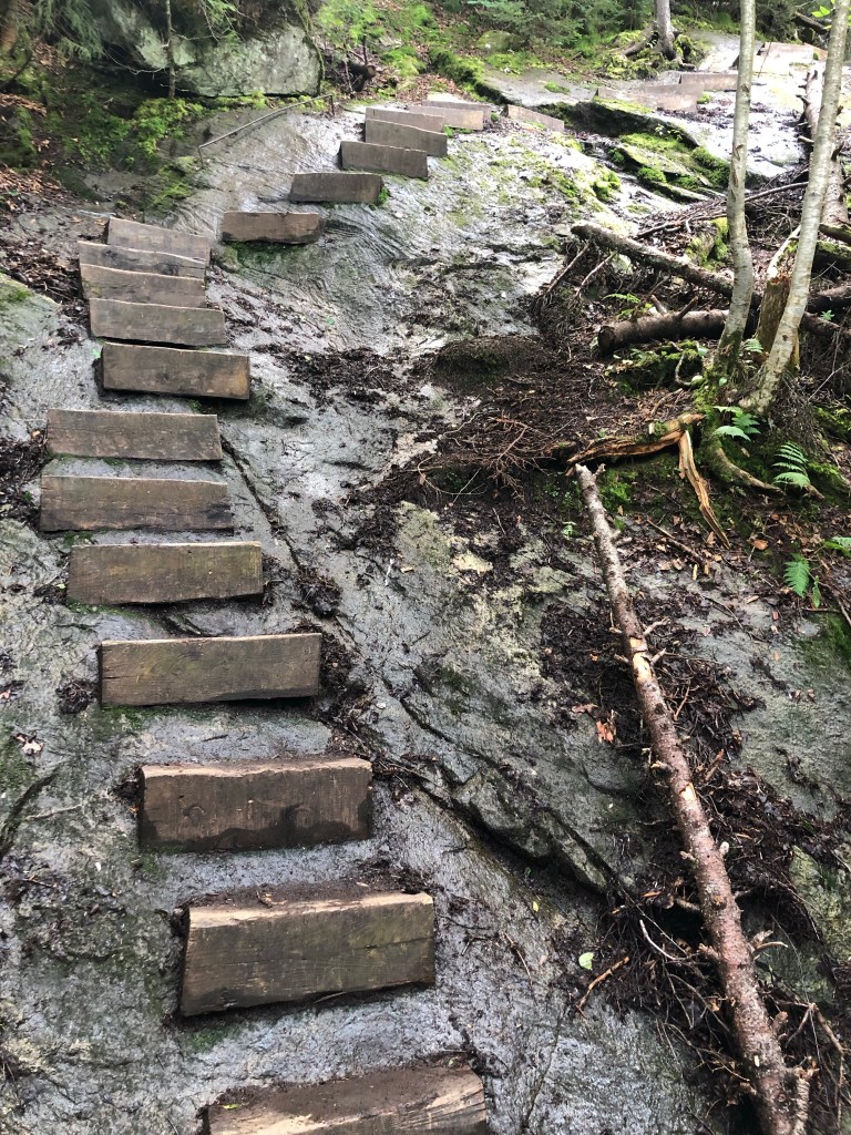
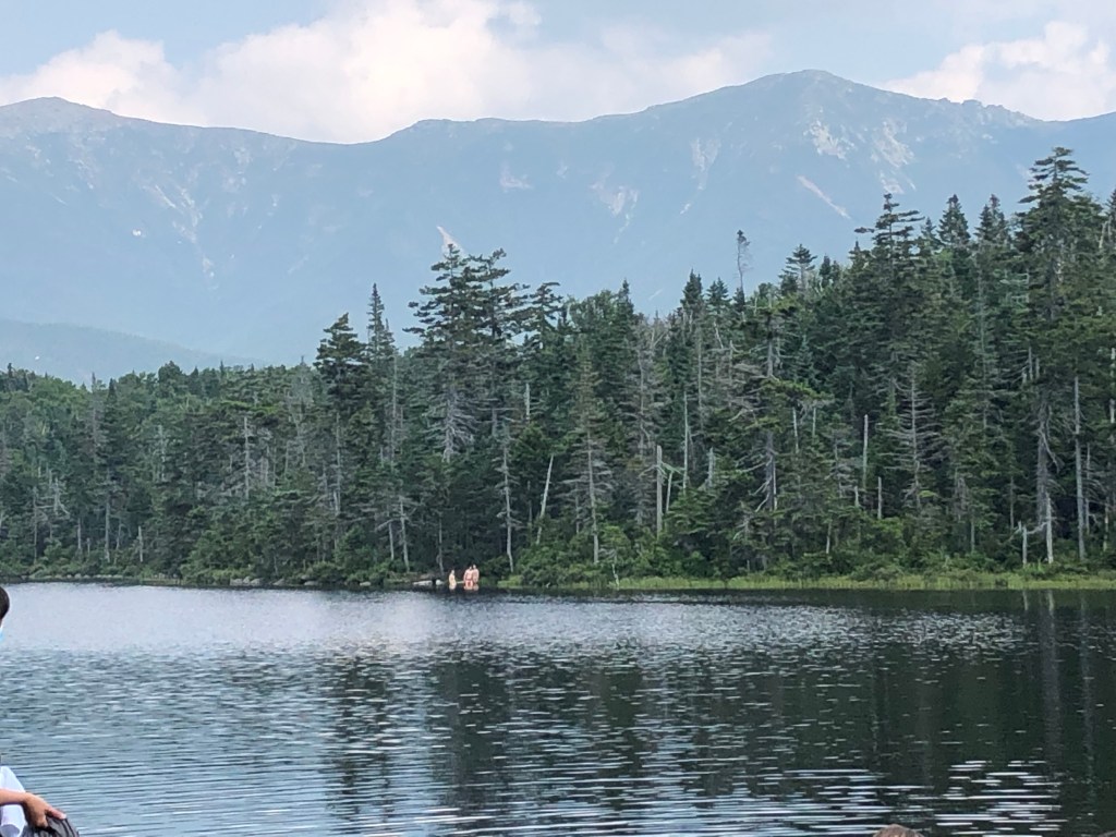
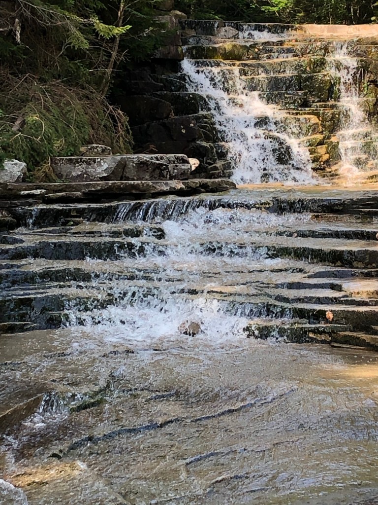
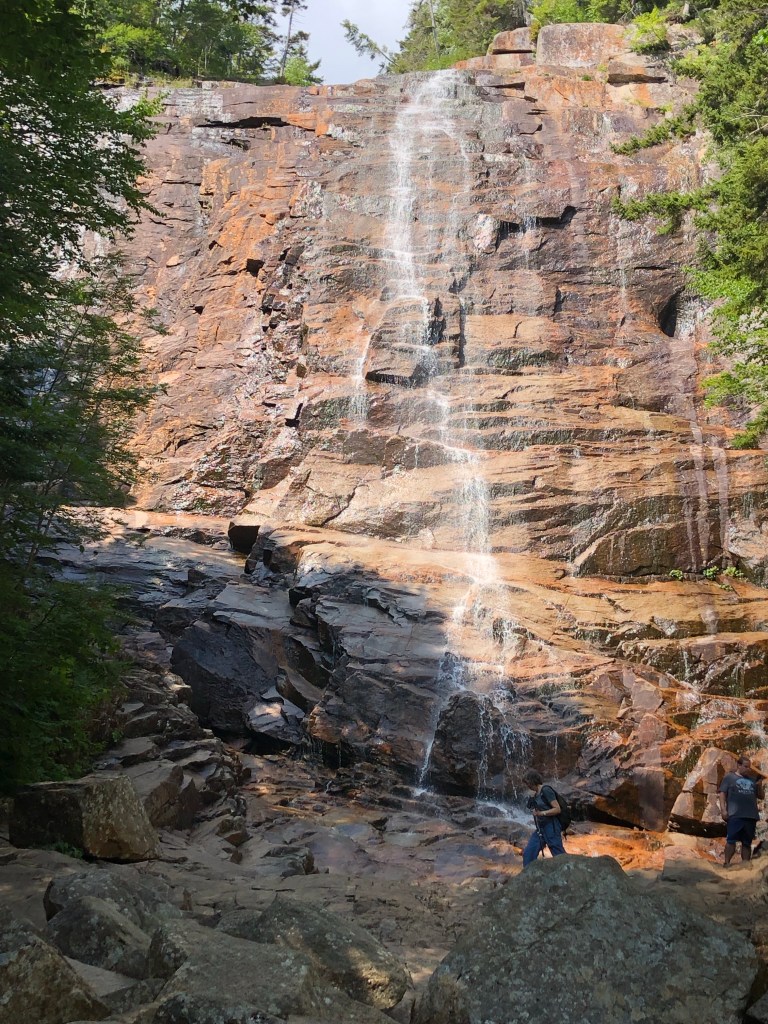
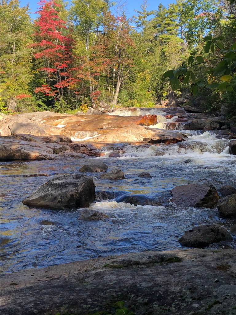
The following morning, the 19th, brought crisp, clear skies. With temperatures in the 30s, a thick mist was rising off the Penobscot. The first couple of miles hiking in Baxter Park was like a walk in the park; the AT was a rock and root-free path that followed the river. It didn’t take long for me to remove my down jacket and zip off pant legs. The trail then followed a stream filled with cascades and waterfalls. I ate lunch at a picnic table next to a lake with views of Katahdin. When I reached my destination at Katahdin Stream Campground, I hitched a ride to the group campsite which was three miles up the road. It’s easy for an old guy with a backpack to get a ride when he is in a park filled with hikers. The Umberger’s arrived at the campground later in the afternoon.

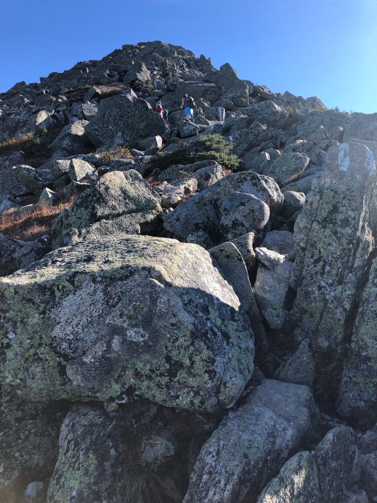
We departed for the Katahdin trailhead at 5:30 on the morning of the 20th. Once again we were bundled up because the temperatures were in the 30s. As the ten of us (the Umberger kid’s granddad hiked the first couple of miles with them) headed up the trail with our headlamps lighting the way, some of my apprehension started to fade.

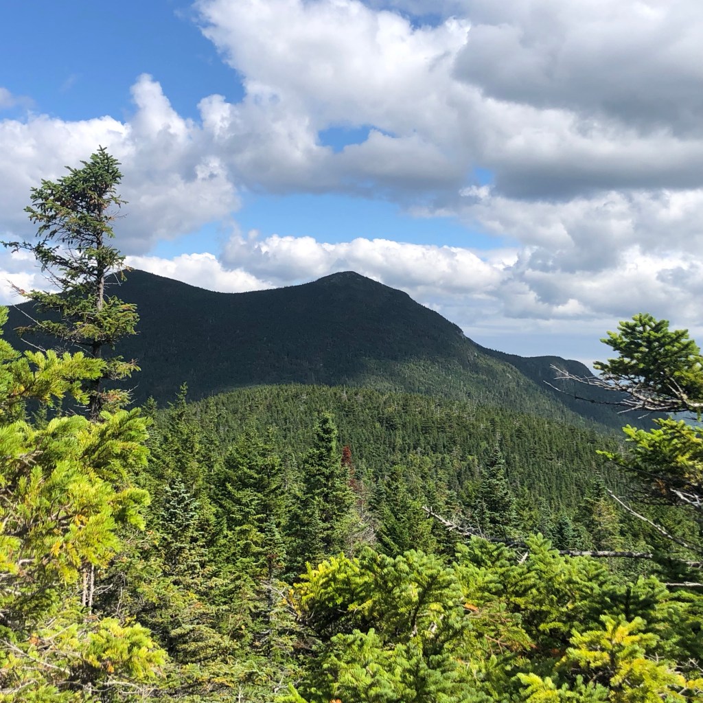
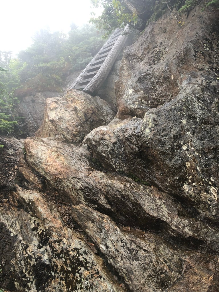
I hadn’t been looking forward to this climb.  The ascent up Katahdin is the longest one on the AT and I remembered what the climbs in the White Mountains were like.  Thankfully, my expectations were completely wrong for the following reasons:

  1. It was dark for the first thirty minutes. Night hiking makes things a little more interesting.
  2. It was cool. The high temperatures and humidity I had while in the Whites was draining. I do better in cooler weather.
  3. I wasn’t alone. Talking while hiking takes my mind off my tired legs.
  4. I wasn’t carrying a 30 lb pack. Since we were returning to the parking area, I was able to leave all my camping gear in the Umberger’s van.
  5. The scenery and vistas were stunning.
View while ascending

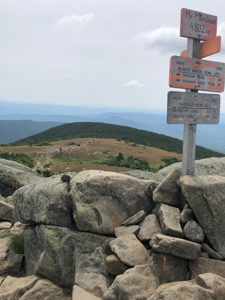
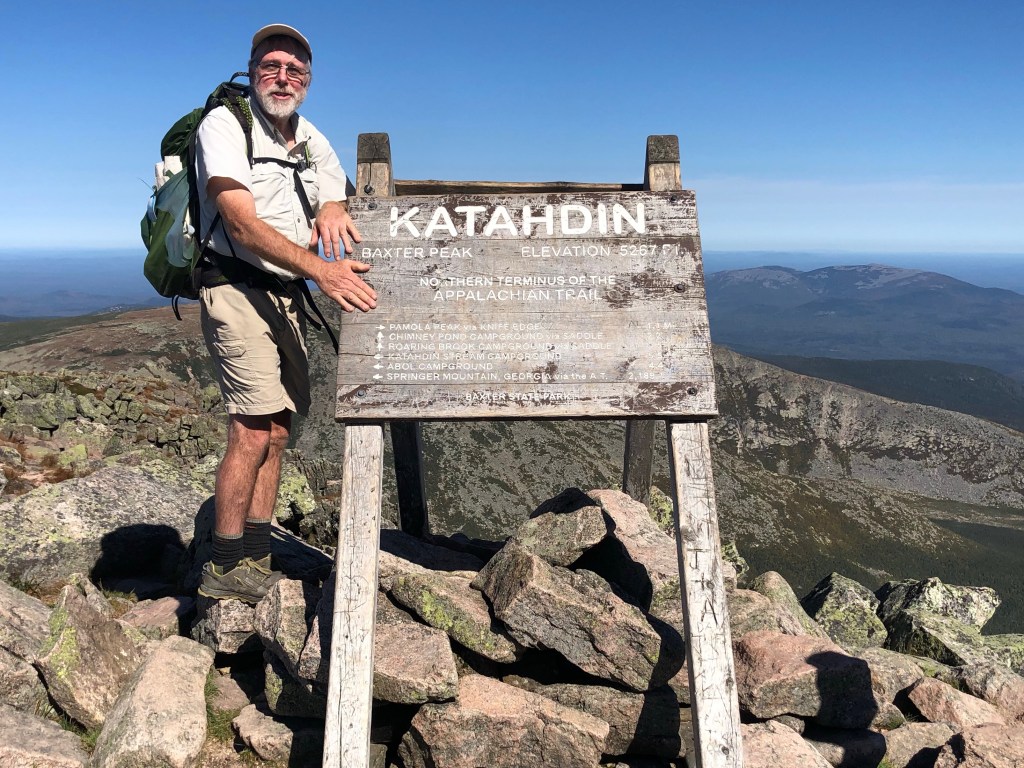
During the few quiet moments that I had while climbing, I reflected on how this journey started as a pipe dream and how the idea captured my imagination even though I really didn’t think it would be a possibility for me. When I concluded this might be a possibility, I remember the hours I spent walking and hiking to get my legs in shape and thinking “This is getting me one step closer to Katahdin.” I remember reverently touching the old Katahdin sign that is now in the Appalachian Trail Museum. This ascent was the culmination of a couple of years of dreaming and then a couple of years of planning.

The hardest step of an epic journey is the first one.  The one where you turn your back on the past, the painful step of leaving, of walking toward an uncertain future.  The odds are stacked against you when you take that step; the shadow of failure nearly envelopes you.  And yet I take that first step, because not to start is failure.

I always tried to make this trip about the journey, not the destination. Katahdin marked the end of the journey, but not the goal. So there I was, climbing over rocks and occasionally pausing to figure out how to clamber over some huge boulders, with a big grin on my face and a heart full of thanksgiving.

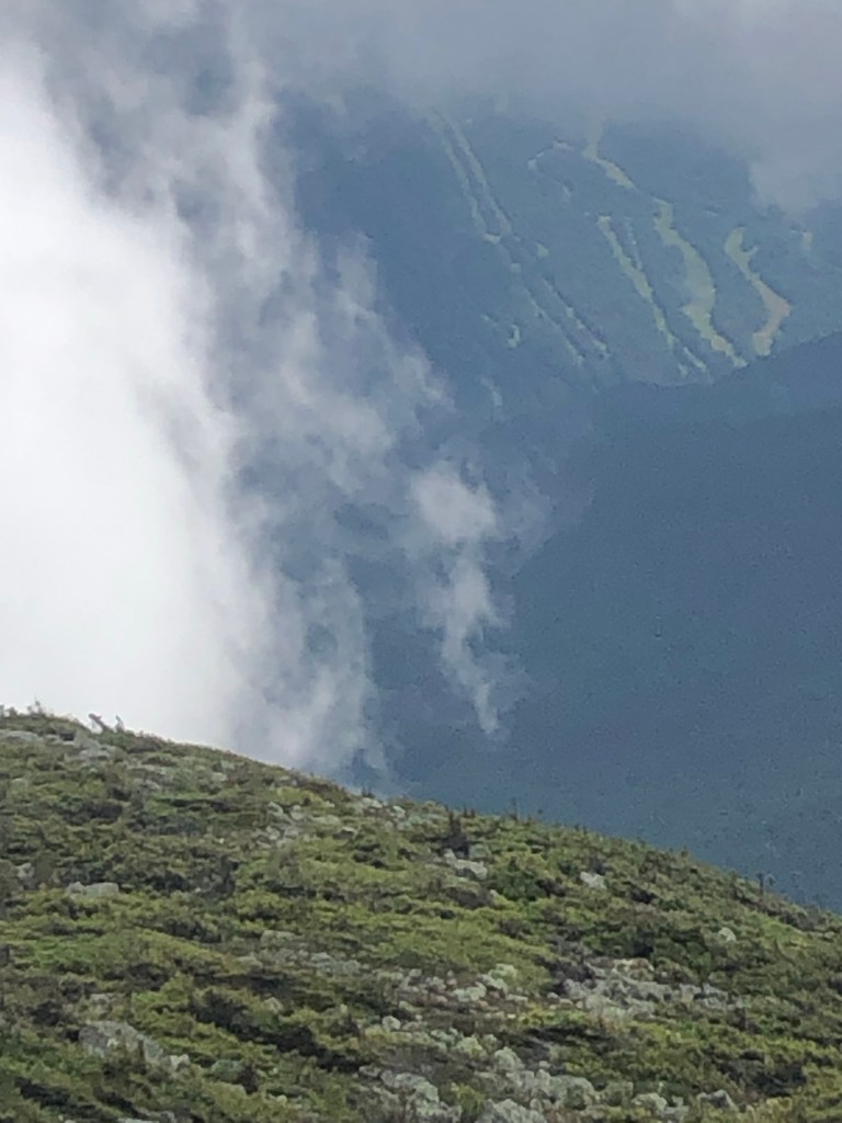
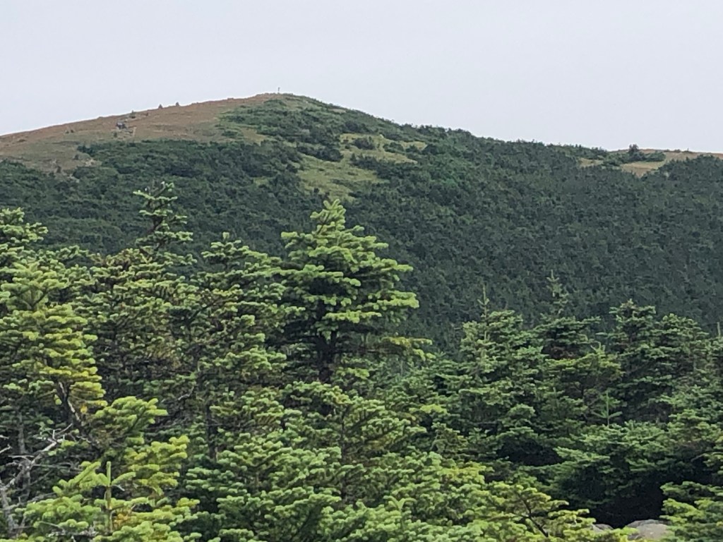
We shed our cold weather clothing after thirty minutes of hiking. After being teased with occasional glimpses of adjacent mountains as we gained elevation, we finally broke out above the tree line and our eyes drank in the scenery around us. While the temperatures on mountain tops may occasionally be mild, it is the truly rare day when there is no wind. Well guess what? Not only were we blessed with clear skies and temperatures in the 60s, but the winds were under five mph.

“Knife’s Edge” from the summit of Katahdin.

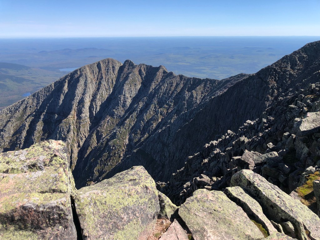
Reaching the summit is like a commencement ceremony- touching the summit sign was receiving my diploma. Lots of congratulations are received from all hikers: thru, section, and day. The thru hikers are my fellow classmates but it was fun to see the sparkle of admiration and the glint of a dream in the eyes of the section and day hikers.

Lots of pictures were taken. I ate my soggy sub sandwich for lunch, thankful that I didn’t have to eat another tortilla wrap. Then we made our careful descent.

Tex, a mule wrangler at the Grand Canyon. You can view her trip on “Lisa P hikes”

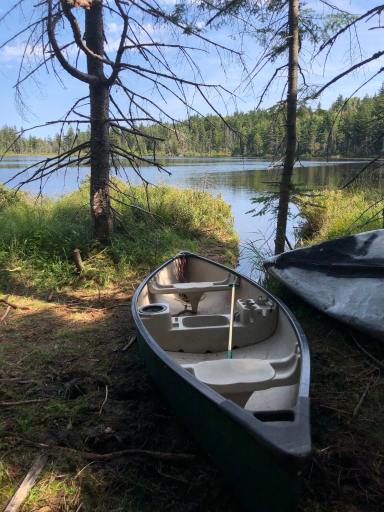
Back at the trailhead, I reloaded my pack, said goodbye to the Umbergers, stuck out my thumb and within minutes I was riding to Millinocket.  I was so grateful that our neighbor and friend Sue Seacord, coordinated the end of her Maine canoe trip to coincide with my summit day so that she could give me a ride home.

While I enjoyed the scenery and sleeping in the woods, my fondest memories of this hike are of the people I met and the conversations we had. I’m thankful for the encouragement I got from other hikers, the folks that stopped to give me a ride, the trail magic I received, friends who invited me into their homes, and the encouraging comments from this blog’s followers. Most of all, I’m especially thankful for the support I received from my family. It was my wife, Anita, who pushed me to have a dream and chase after it. May I learn to practice hospitality and encouragement just as these people have done for me.

Post #34 Heading Toward the Barn

I nero at the Sterling Inn in Caratunk where I also resupply. The inn has a good selection of food for hikers to buy as well. When I resupply at a grocery store, I often can’t purchase food in the quantities that I want. For instance, I can’t purchase a single ramen noodle packet; I have to buy a package of five. Or I can’t buy a single mini tub serving of peanut butter; I have to buy eight. Who wants to eat peanut butter every day for lunch or ramen every evening for supper? So a good hiker resupply sells single servings of peanut butter, ramen, spam, pasta, dry milk, Oreos, Fig Newtons, dry fruit, nuts, freeze dried meals, small packets of olive oil, condiments, etc.

Antique fixtures at the Sterling Inn

Last Labor Day I wrote about the loneliness and feelings of being left behind that I experience on Labor Days. This Labor Day morning, while my pack is heavy from my resupply in Caratunk, my heart is even heavier. While I hike, friends of mine mourn the loss of their first born. Life isn’t fair.

I have only one 1500 foot ascent to climb on both 9/6 and 9/7. The summits of both mountains afford pretty decent views. Baxter Peak (Katahdin) is now showing up on my PeakFinder app, but it’s not quite visible in real life; the humidity has to be a little lower and the cloud ceiling has to be a little higher. It’s exciting to think that the end is nearly in sight.

Along with seeing a few more splashes of color on the trees, the late summer crickets are telling me that change is in the air. The later sunrise times and the chilly early morning temperatures make it harder for me to crawl out from beneath my toasty down quilt. While camping near Sheep Dog, I feel good about getting up before the sun, but then I realize that she is already on the trail! Oh well: I hike to the beat of a different drummer.

Where I’ve been

I end this section of trail with a Nero in Monson, ME. During this time I make preparations for the 100 Mile Wilderness. This is the most remote section of the AT. I could carry nine days of food with me, but instead choose to pay the additional cost of having an outfitter drop off half of my resuppy food at a location where the AT intersects a logging road. This will make my pack six to eight pounds lighter during the first half of the 100 Mile Wilderness.

Where I’m going

I am like an old mule that feels energized because it is heading towards the barn.

Post #33 Support

I spent the nights of August 31 and September 1 at the Maine Roadhouse so that I could have a much needed zero day. The owners, Jen and Jen, just opened the hostel a couple months ago and provided everything a hiker could want: Shuttle rides to and from the trailhead and into town; a rec-room and lounge; private rooms and a bunk room where all the beds have reading lights and privacy curtains; laundry facilities; a common kitchen and dining room; re-supply food; a hearty breakfast each morning; and outdoor furniture, picnic tables and grill.

The Maine Roadhouse

While at the hostel I met Bone Spur, the Chappalachian Hiker. He is this year’s AT chaplain that the United Methodist church has chosen to minister to the hiking community. This ministry was born at a church down south that ministers to hikers by letting them sleep in their basement and providing breakfast for them during the spring thru hiking season.

The Bigelow Mountains were the last of the 4000’ peaks that I had to climb until Katahdin. As I hiked up these peaks, a cold front from Hurricane Ida moved into western Maine. I had been wondering if bringing my down puffy jacket had been a mistake. I was thankful I had it while camping at higher elevations where the night temperatures were in the low 40s.

The Bigelows

At the first road crossing after the Bigelows, some volunteers from the Maine Appalachian Trail Club treated the thru hikers to trail magic: Cheeseburgers, chips, potato salad, and drinks. They have been doing this event for twenty years in a row. What a treat!

Trail Magic!

The day after the trail magic, I finally found what I was looking for- a day without mountains! I spent the hours hiking from lake to lake. If the temperatures had been warmer, I would have gone swimming! It’s always a treat to camp next to a lake and listen to the loons at night.

Dusk on Pierce Pond

The morning of my Nero at Caratunk, I took advantage of the opportunity to experience an old Maine sportsman’s camp. For a fee, this off the grid, the rustic camp lets hikers join them for a pancake breakfast. It was fun chatting with the owner and getting to know some more hikers. After breakfast, I hiked back to my camp, packed up, headed to the canoe ferry to cross the Kennebec River, and then headed to town for resuppy and a bed.

Read the “River dangers”
A little different than the Champlain Ferries
I was hiking along with my head down so I wouldn’t trip when I saw a note on a rock: “There is an active bees nest just ahead of you “

Post #32. The Maine Thing

Maine is starting to grow on me. I’m beginning to spend a little more time walking and a little less time clambering over boulders. I’m climbing some steep mountains but I’m not spending all day doing so. A couple of hours each day are spent hiking on a moderate grade where I can get into a consistent stride on a mostly dirt trail or a path in the woods.

Many backcountry ponds have canoes stashed next to them that hikers will occasionally use.

A few miles of each day is now spent in open hardwood forests, which has been a pleasant change from the dense spruce or boreal forests. Another change is that I’m seeing more lakes and ponds, sometimes up close or off in the distance. The mountain blueberries are a treat that I will hate to see end. Additionally, noticing lots of moose scat reminds me of the exciting possibility of actually seeing one of those big guys!

In this age, there is an app for everything. There are couple of apps that are making this portion of my hike richer. Have you ever been outdoors and heard a bird sing and wished you knew what kind of bird you were hearing? With Cornell’s Merlin Bird ID app, as I record the bird song the app will show me what kind of bird or birds I’m hearing. Pretty cool!

Witch Hobble

Most of the time I spend hours reaching a mountain summit and am rewarded with a great view, usually of other mountains. But the problem is that I don’t have a clue which mountains I’m seeing. My PeakFinder app will tell me the names of all those mountains. All this information helps to satisfy my curiosity.

I have many thirty second conversations with NOBOs as I step off the trail to allow them to pass, wondering what the odds are of seeing them again since they are moving at a pace that I can’t duplicate.  But sometimes I’ll see them that evening because we choose to stay at the same campsite or I may see them again three days later or a week later because they choose to take a zero day while I continue to hike.

I met Truck Stop while taking a break a few miles before Franconia Notch, where he was getting off to zero. As he passed me again, three days later, I marveled at his pace, how he is as fit as a thoroughbred racehorse and appears to be about my age.

Ramen for supper!

I was a little less envious of him after another encounter with him four days later, when he shared that he had to have his doctor put his hip back into place. When I met him again on the 27th, Truck Stop shared that he had to have his hip put back in place again and his inspiring story of overcoming an accident 18 months ago, damaging his hips, pelvis, vertebrae, and discs. Here he is doing a thru hike after over a year of rehab and painful disc decompression procedures. Now I’m no longer envious of him; I’m in awe. If his hip stays in place, I won’t see Truck Stop again because he will be days ahead of me, but I am blessed by our brief encounters. My prayer is that I would be a blessing to the other hikers I meet, no matter how brief the exchange.

Dawn on South Pond. “Red in the morning, sailors take warning” proved to be accurate.

While re-supplying in Rangeley, ME, I check out the visitor information center. A kiosk shows me another trail that I could take, one which will lead me to my backyard: the Northern Forest Canoe Trail. And today’s fun fact: Rangeley, ME is also known to be exactly halfway between the North Pole and the equator.

A thru hiker noting their accomplishment in moss.

Until next time, happy trails from western Maine.

Post #31 Mahoosuc Notch

8/20.  It takes about 30 seconds of hitching for me to get picked up and taken back to the trailhead from Gorham.  The guy who picks me up is about my age with the same occupation, and says he has had one too many things go wrong this week so he is going on a day hike to clear his head.  The weather is hot and humid and I’m glad I choose to go only 6.5 miles today.

This afternoon I see a porcupine and I reach the 1900 mile marker.

I got spoiled when hiking the AT last year.  When I wanted to stay in a motel, I didn’t need to worry about advanced reservations; I could just drop in and they always had vacancies because of COVID-19.  It is a whole different story this year- if I want a room, I need to contact hostels and motels at least two or three days in advance of my arrival, which is challenging since I usually don’t have cell service.  This past week I’ve been lucky to find places that have had cancellations.  So before I lose cell service this morning, I make reservations for a room in Bethel, a one motel town which is a three day walk from here.

8/21. This morning I pour my Special K cereal into my small pot, sprinkle some powdered milk over it, add water, stir and dig in. Wnen I take the first bite, I immediately remember that three weeks ago I had emptied a couple of packets of unsweetened lemonade mix into a zip lock baggie and put it with my food stuff. Nope, that is not powder milk my cereal is soaking in. Since I would have to pack out the soggy cereal so that animals don’t get it, I choose to drain the cereal flavored lemonade into my water bottle and eat the cereal as it is. MMM!

A couple of milestones today: I leave the White Mountain National Forest and a couple of hours later, I enter Maine, the fourteenth state that the AT traverses.

8/22. I awake thankful- thankful that no critters got my food because I was unable to hang it up in a tree properly last night. And I am thankful that it wasn’t windy and no dead trees fell on me since I was unable to find a stealth site that wasn’t near a dead one.

One of the challenges in Mahoosuc Notch

It takes two hours to traverse the one mile stretch called Mahoosuc Notch. I climb over and under boulders, leap from one boulder to the next, and remove my pack to squeeze or crawl through tight openings. This requires patience. I take my time and enjoy the challenge (and I take my time so I don’t break my neck). Oh, by the way, everything is wet from the mist that has been falling. I let out a whoop! celebrating my completion of that challenging mile.

Spruce Grouse

Since hurricane Henri has been giving us light rain all day, I take great care to keep my hammock, down quilts, and camp clothes dry while setting up camp tonight.  I have to keep the wet stuff that I’m wearing from touching the dry stuff.  I manage to stay dry throughout the night.

8/23. It’s not much fun packing away wet gear. Typically I would be putting on my wet hiking clothes but today I wear some of my dry camp clothes because I know I will be spending tonight in town for a resuppy and will do my laundry then.

While waiting for my shuttle ride at the trailhead, I enjoy trail magic provided by a couple of guys who just completed their thru hike three days ago. They want to give back to the Trail before heading home to Wisconsin. Since it is nearly noon, I devour the sandwich, Doritos, and Coke they set out for me.

My room looks like my pack exploded as I’m trying to dry my wet gear. This motel is located nearly 20 miles from the trail, but since they offer a free shuttle to and from the AT and to the grocery store, and they have a guest kitchen, they get quite a few thru hikers staying with them. With laundry and shower complete, I’m off to the grocery store!

Some of this Maine terrain is too steep to climb without help

Post #30 Wildcats and Carters

Pond and cliffs in Carter Notch

August 16. Monday-  I am amazed at how many hikers are in Gorham during my zero day. In addition to the various hikers I see that receive just a nod and wave from me, there are a few I actually chat with, and others whom I met earlier on the trail that stop and catch up with me.  There is one woman in particular -“Annie Oscar the Grouch Walker” is her name- that I seem to keep bumping into every couple of days.  I chatted with her and her dog, Oscar the Grouch, passing on the street.

For me, a zero day means that I don’t do any trail miles but I will do town miles as I visit several stores to get supplies and food to last for the next three to six days. My food calculations depend on road crossings and their proximity to a town. Today I did two town miles.

When I went to answer nature’s call at 2 AM, my bare foot found this guy’s cousin in my Crocs

Tuesday-  I have a history of forgetting things in rooms when I leave to get back on the trail: hat, sandwich, bratwurst, etc.  So I no longer rush out the door and will take an extra minute or two to check around the perimeter of the bed, in the bathroom or shower, on clothing racks, etc.  If only I could remember to check in the mini-fridge!  Three blocks away and moments before boarding the AMC shuttle to return to Pinkham Notch I remember that I left my turkey sub in the fridge ……ARGH!  Goodbye to today’s special lunch!

The trail up the Wildcat mountains from Pinkham Notch may well be the steepest six mile stretch of trail that I’ve been on. I spend seven hours covering those miles, and yet, perhaps due to fresh legs and the thousands of hours of trail work volunteers spent maneuvering 300 pound rocks to create stepping stones, I find it manageable. I later descend these mountains cautiously because the sloping rocks are wet from the intermittent light sprinkling of rain. My right knee and shin are scraped up from a couple of slips and skids.

Thursday- my third day of hiking the Wildcat and Carter mountains. While waiting for a brief rain shower to cease before packing up my rain fly and hammock, the meditation I read reminds me to set aside my agenda and expectations so that I can receive what actually shows up. Desiring community while on the trail is something I want but it may not happen. It would be better for me to set aside that desire, open my eyes and receive what God has set before me.

Big Bird, Green, Daddy Longlegs, and Honey Buns include me in their selfie.

I hear an ominous weather forecast- 1-2” of rain in the next 24 hours. So, shortly before noon I arrive at NH Rt. 2, stick out my thumb, get a ride within 10 minutes, and head back to Gorham for another resuppy and a night in a dry room. During the hitch to town, I meet Lifesaver, another hiker heading for town.

Early morning from Mt Moriah

Lifesaver and I chat during lunch at McD’s.  She is heading to Canada to visit her parents and then home to Israel in time to observe the Jewish holidays in September:

  • Rosh Hashanah (new year celebration)
  • Yom Kippur (day of atonement)
  • Sukkot (commemorating the Exodus)
  • Simchat Torah (celebrating the Torah)

We say our goodbyes and I head to Gorham Hardware for alcohol fuel, Dollar General for trail food, and the motel for a shower.

Next up: The Maine border.

Post #29 The Presidents

During the first several days of hiking through the Whites, I meet a few SOBOs but now a big bubble of NOBOs has been passing me and we frequently camp at the same site. While explaining my hike, I often say that I just restarted my trip north, don’t have my trail legs, and ate too many potato chips over the winter. But I have come to my senses and realize there is no such thing as too many potato chips. For my funeral, I want to be lying in my casket with an open bag of Martin’s BBQ Potato Chips to share with mourners/celebraters one last time.

I clamber over Franconia Ridge on Monday and Tuesday. On Wednesday, when I arrive at the two mile level stretch of trail between Zealand Hut and Thoreau Falls, I am so grateful to be walking on a nearly rock-free path that I want to drop to my knees and kiss the dirt.

View from Franconia ridge

If one packs their fears, then I must fear hunger; I regret the extra pounds that I’m carrying due to my food quantity miscalculation.  You would think that after spending over 150 days on the trail I would know better.

Thursday’s 6.5 mile ascent from Crawford Notch to Mizpah Springs Hut and the Nauman campsite is a real draining slog. The heat and humidity are my kryptonite. The reasons I chose to wait until August to continue my hike are that there would be fewer bugs and lower temperatures and humidity; at least I am half right. I take solace in hearing some 25 year old thru hikers complain about the climb. If I could just find a phone booth to change in, the rest of this hike would be a breeze.

Crawford Notch

Traverse of the White Mountains’ Presidential Range is no joke. This alpine area has extreme weather (the highest wind speed ever recorded of over 200 mph), trails that are nothing but boulders, rocks that are no fun to walk on, and magnificent scenery on the days when the mountains are not enveloped by clouds.

Mt Washington

It appears that most of the people who do this 25 mile traverse will make day hikes out of their trips by staying in at least two of the three alpine huts that the Appalachian Mountain Club has in this mountain range. These reservation-only huts can sleep 60-100 people in small dormitory rooms that hold nine bunks each. Breakfast and dinner is provided, but no linens or showers. I believe all the food is carried in daily. Everything there is solar powered, including the limited lighting, wastewater treatment and kitchen equipment. The sixteen 100 gallon propane tanks are flown in by helicopter. Non-guests, like thru hikers, can re-fill their water bottles, use the restroom, and occasionally score some leftovers and coffee.

Lake of the Clouds hit

As I hike over Mount Washington on Friday, I question whether I made the right decision to not bring sunscreen… reducing my pack’s weight by three ounces. This glorious day is overshadowed by the difficulty of clambering over boulders all day long. The summit of Washington is crowded with tourists, because, being a lot smarter than yours truly, they arrive by either driving up the toll highway or via the cog railway. I do take advantage of the summit’s amenities: restrooms and a cafeteria.

Because of the rocks, the only camping opportunities are on platforms below timberline, over a mile off the AT. I spend Friday night camped on the side of the mountain on a platform a few feet away from other backpackers. I enjoy chatting with a couple of guys that were childhood friends in Nepal, attended college in the US, and remain friends twenty years later.

My Saturday morning departure from camp is delayed by a brief rain shower. Ascending Mts. Jefferson, Clay, and Adams is uneventful. I score some leftover spice cake at the Madison Springs Hut and climb another thousand feet to the summit of Mt. Madison, which is totally socked in by clouds. The gentle breeze soon becomes a 50 mph wind with horizontal rain pelting me! I choose to continue moving forward, slowly descending, getting closer to the tree line. My progress for the next mile is not much faster than a crawl; I carefully place each footstep on the slippery boulders and try not to lose my balance in the buffeting wind. I walk hunched over and with a wide stance to reduce the risk of getting blown over and getting hurt if I do fall. I frequently pause to locate the next cairn in the fog or to rest in the lea of a huge boulder. Boy, there is nothing like a little fear to make one “pray without ceasing”. As I approach timberline the rain stops, the wind speed decreases a little, and the clouds start to break up. An hour later I’m setting up camp at a wonderful campsite and sleep really well all night.

My Madison; the calm before tempest.

Sunday gives me one final Mt. Washington experience: I previously mentioned the toll road that goes up to the summit. The AT crosses that road a couple miles from the Pinkham Notch Visitors’ Center. All morning I could hear the traffic going up the highway as I drew nearer. Some of the cars sounded like motorcycles without mufflers. This morning there is a car race up the mountain- the Subaru Mount Washington Hillclimb, also known as the Climb to the Clouds. Since it is a timed race and it appears that each car starts about one minute apart, race volunteers encourage me to briskly walk across the road between cars. I sit and watch the race for twenty minutes.

Racers slow to navigate corner adjacent to my vantage point

My plan to get a shuttle from Pinkham Notch to Gorham and spend Monday letting my legs recover from the wear and tear these mountains put on them is scuttled since there are no motel or hostel vacancies thanks to the car race. I move on to plan B and make a stealth campsite a quarter mile from Pinkham Notch, set up camp, and return to the visitor center and spend the rest of the afternoon hanging out in the hiker lounge, charging my phone and battery block, and documenting the events of the past few days. Then on Monday morning, I catch the 7:30 AMC shuttle to Gorham.

Next up: the Wildcat Mts.

Wildcat ski are is seen through a break in the clouds

Post #28: Slack Packing

Mt Moosilauke

Tuesday, August 3 
We arrive at the southwestern border of the White mountains at noon, eat lunch, and I hike half a day.  Anita picks me up and we head to our rental up north in Bethlehem, NH.  The brewery that is a couple of blocks away looks like a fun place to eat, but I am too hungry and impatient to wait 40 minutes to be seated.  So instead, Anita and I spend the next hour driving around looking for a restaurant that is open on this Tuesday evening.  In the end, we have to settle for a pizza and I have to apologize to Anita for my impatience.  I vow to do better tomorrow night.

A lone Indian pipe in a sea of moss

Wednesday, August 4
Following a drive on an interstate, state highway, and finally a US Forest Service road, we arrive at the trailhead for Mt. Moosilauke and Kinsman Pass.  Moosilauke is the first peak I encounter in the Whites that is above treeline.  Above treeline, the ground, or should I say rocks, are covered with fragile alpine grasses and plants.  The ascent on the west trail is not as steep as the east side’s descent, which requires careful foot placement on boulders, chiseled spots on the steep granite, and timbers pinned to the rock.  My biggest takeaways: 1.  I think I can do this, and 2: The miles are a lot longer here.

Timbers pinned to granite

Anita meets me along a cascading waterfall as I approach Kinsman Notch and tells me about the waterfalls she hiked along and the moose she saw a few minutes after dropping me off, earlier this morning. We drive to our rental, have showers, and I determine to make up for the previous evening’s debacle. We walk back to that cool brewery. ARGH! Stymied again! They are closed on Wednesdays! Sigh……We head for a neighboring town for dinner.

Cairns

Thursday, August 5

My next section of the Whites requires an overnight. After making acquaintances with “Carjack” at the Kinsman Notch trailhead, I climb/scramble up Mt Wolf with my pack loaded with camping gear and two days of food. Since we have a similar pace due to our vintage, Carjack and I spend half of these two days hiking and camping with each other. She started at Dartmouth in Hanover and is doing a 200 mile section of the AT during the next three weeks.

I seem to be meeting more SoBos than NoBos. These SoBos have been on the trail for about six weeks and are feeling optimistic (after a couple of days without rain) as they near the end of the most arduous part of the trail.

As I hiked towards Franconia Notch, I mustered up enough courage to take a dip in the cool waters of Lonesome Lake

Friday, August 6

I find that the first night sleeping in a tent or hammock is often restless and this particular night is no exception. I leave camp at a reasonable time and Carjack once again catches up to me around noon on the second day and we spend the afternoon carefully descending Kinsman mountain together, to meet Anita at Franconia Notch after her day of exploring waterfalls.

From summit of Moosilauke

We drive Carjack to her hostel, a few miles down the road and repeat Wednesday evening’s routine. This time we find ourselves chatting and playing cornhole for an hour until we are finally seated at an outdoor table at the “Rek’-Lis” brewery.  We did make the mistake of getting a “small” order of nachos topped with pulled pork, jalapeños,  beans and cheese, not realizing that it could feed six.  So we saved our entrees for the next evening’s meal.

Saturday, August 7

After hearing how crowded the backcountry campsites get on weekends, I decide to take a zero today and join Anita for a trip down to Portsmouth where we have a brief rendezvous with Kaytlin and Hannah. Hannah has an internship with an artist in Portsmouth, and Kaytlin is enroute to her vacation in Maine, so this works out well. Since the section of the AT ahead of me has longer roadless sections and Anita can no longer shuttle me around, I spend most of the travel time poring over maps and guides, trying to figure out where I can resuppy and determining how many days of food I need to pack. I finally decide on a tentative plan and check the weather forecast, since I’ll be spending a lot of time hiking above treeline.

Sunday, August 8

Uh-oh, afternoon thunderstorms are forecast; it’s not a good idea to get caught in a thunderstorm above tree line. With much angst, I reluctantly turn my zero into a double zero. Thankfully I get to spend this extra day exploring a few waterfalls with Anita.

Yep, that’s Anita in the foreground

And now I’m sitting here writing this while looking out at sunny skies.  Being flexible and adaptable is the name of the game.  I’m glad I’m not on a schedule.  We’ll be in touch.

Post #27: Lists

Our morning visitor
  • Inspect water bottle, hammock, and rain fly
  • Buy reflective cord, groceries, toothpaste, shirt, AAA batteries
  • Replace screen protector, update blog, invoice customer
  • Apply permethrin to clothing, fluff down quilts
  • Take tools out of truck, renew truck registration and pay insurance
  • Download an e-book and audio book

Yep, its time to take care of the unfinished business I have with this trail. I’ve avoided scheduling work during August and September so I’ll have time to do this. I made a list – a list that seems to grow longer every time I mark something complete. You all know what it’s like when you plan for a trip.

Technology has made it a lot of easier to stay in touch with home when traveling. Of course, since I will be in the back country much of the time, I won’t often have cell service. Its kind of like living in the Adirondacks; the small communities may have cell service, but between those villages are lots of dead areas. We have to travel either a mile up the road or down the road from our home to pick up a solid signal. A while ago I looked at Verizon’s map of their cell coverage of the 14 states I would be hiking through and it wasn’t hard to figure out where the AT was; I could trace a line up the map with the least amount of cell coverage and know that’s where the trail is. When hiking last year, I discovered that I needed to take advantage of the reception I had while up on the mountain ridges in the middle of the day, because if I tried to wait until I got to camp in the evening, I wouldn’t have reception. Most AT camp sites and shelters are in gaps or lower elevation areas where there is a water source and lots of mountains between me and the Verizon tower.

Here is a little known fact that I learned from a podcast that could save your life: If you have an emergency and want to call 911 but your phone says you have no service, dial 911 anyway. Your call may reach another cell service provider’s tower and federal law now requires all cell providers to forward all 911 calls to the authorities, even if it is a signal from someone who is out of network. And the authorities can usually determine the location of the caller.

Early spring from St. Regis mountain

Anita will be taking me back to the southwest border of the White Mountains National Forest in New Hampshire, where my journey north ended last August. She has rented an AirB&B for the week and will help me to slack pack through the first half of the Whites. This means she will pick me up at the day’s end and drop me off at the same spot the following morning. I won’t have to carry all my camping gear and food which means my pack will be much lighter! During the days, she plans to relax by reading, walking, viewing some local waterfalls, and even visiting Hannah one day. YIPPEE!

Rainbow Lake

Some would say that by the time NOBO (Northbound) thru hikers reach the Whites, they have walked 80% of the length of the trail but have only expended 20% effort required to hike the entire trail. Yep, the White Mountains and Maine are tough, but most NOBO thru hikers are usually in good shape by the time they arrive in NH. So it’s unfortunate for me that my original NOBO plans didn’t work out, because try as I might, I’m not in the same physical condition I was in last October; I’ve done a fair amount of hiking this summer in addition to eating too many snacks. Oh well. That means I need to lower my expectations regarding how far I can go in a day. Once again, I’m not real confident that I can do this, but I’ll give it a go…I’m not going to let the fear of failure stop me.

So I’m loading my pack, donning my trail moniker, crossing “update blog” from my list, and am looking for the next resupply. I will keep you updated. The attached photos are from some of my Adirondack day hikes. Thanks for following me.

Post #26 Smokies

When I was in Erwin, TN, last March, a guy by the name of Doug provided rides for me, so I once again decided to use his shuttle services. I appreciated him going out of his way to assist me in procuring some freeze-dried food and alcohol fuel, because the local outfitter, from whom one would normally purchase such supplies, was closed. During this resupply, I also had to take additional time to get a permit for back country camping in the Great Smoky Mountains National Park (GSMNP). This is usually done on their web page, but it required a phone call this time around since their site wasn’t functioning properly. After getting properly provisioned and rested, Doug and I made the 90 minute drive to Davenport Gap, the eastern (northern via the AT) entrance of the GSMNP.

  If you look at a map, some of you may notice that I skipped the section of the AT from Erwin to Davenport Gap.  That is because I did that section back in March, when I was heading north, after having to skip around the GSMNP.

Since I didn’t want to take the time to get off the trail to do another resupply in Gatlinburg, I took the unusual step of purchasing and carrying eight days of food in my pack; enough for me to complete my trip. This is noteworthy because when given the choice, AT hikers usually carry only 3-5 days’ stash of food, which weighs approximately 5-8 pounds. So for the first three days, I noticed the additional weight I had chosen to carry; my pack now weighed about 35 pounds, which is about six pounds more than I prefer.

Horses are permitted on the AT in the Smokies

The GSMNP has more of everything: people, rainfall, elevation, trails. The AT reaches its highest elevation as it crests Clingman’s Dome, at 6643 feet. Nearby stands Mount Mitchell at 6684 feet, the highest peak east of the Mississippi. I found the spruce forests around Clingman’s Dome kind of dreary, because the trees grow so closely together that the sunlight can’t penetrate. And due to the amount of rainfall, the forest floor and every tree standing and lying, was covered in a thick layer of moss.

  The mountain peaks in the GSMNP receive up to 85 inches of rainfall per year, which means that it is considered a temperate rainforest.  That comes out to an average of about 1.25 inches per week.  Many thru hikers who travel through the park in March or April find that hiking the AT is more like wading through a stream bed. 

Armed with this information, I steeled myself against what Mother Nature may have in store for me. And once again, my expectations were totally wrong; there was not a cloud in the sky for the next seven days. Now, while that meant dry weather, it also meant cool weather. For the first three day in the Smokies, the nightime temperatures were in the 20s with daytime highs in the low 50s. I would start the day hiking wearing a base layer and a light mid-layer on top, with my pant legs zipped onto my hiking shorts. As soon as the sun was up and I was on the south side of the ridge, I would take a break to remove my pant legs, gloves, and mid-layer. Within a few minutes of removing some clothing layers, I would regret doing so because I would follow the trail around some bend and find myself on the north side of the mountain where the temperatures felt like they were thirty degrees colder!

With over 12.5 million visitors in 2019, the GSMNP is the most visited national park in the country. Each evening I got to meet a handful of those visiting the backcountry as I set up camp at one of the trail shelters. The cool evenings and early nightfall encouraged us to build a campfire each evening for warmth. An inviting campfire draws tired hikers the way fresh poop attracts flies. Fireside conversation is always enjoyable as people get to know one another and trade war stories. One evening I met Hawk, who was completing his fifth AT thru hike. Another evening found me sharing s’mores from three guys who were on their first backpacking trip. I spent a couple days with Flashlight, a previous thru hiker who was presently hiking the southern half of the trail again. I enjoyed hiking with him and was glad that I was able to assist him in finding a ride from Newfound Gap to Gatlinburg, where he had reservations at a hostel for a zero day.

The backcountry rules for the GSMNP do not allow hikers to set up camp adjacent to the shelters; you must stay inside them. Last winter I was stressing out because of this. I remembered the trip Dave Tucker and I made to the Smokies 40 years ago and how we didn’t get much sleep because of the old guy who was snoring next to us. Now, I am that old guy, and who would want to sleep next to me and why should we be packed into a shelter when the rest of the world is trying to physically distance from each other to avoid spreading COVID19? You can imagine my relief to learn that the park service wisely reconsidered their backcountry camping policy and now permits and encourages hikers to camp outside the shelters.

Typical Smokies shelter

After spending five nights in the park, I descended the southwestern slope of the Smokies to exit the park, and was pleasantly surprised to find that the Little Tennessee River valley seemed to have its own micro-climate. The temperatures warmed and there were still orange and red leaves on the trees. This valley is dominated by the 480 foot high Fontana Dam, the tallest dam in the East. In addition to hydro-power, this impoundment also provides lots of boating, camping, and picnicking opportunities. Next to this lake is what AT hikers know as the Fontana Hilton. Its amenities include a solar phone charging station and a heated bathroom with hot showers. Its proximity to a parking area also makes this a popular shelter. But the night I stayed there, I had the place to myself. Go figure!

View from the top of Fontana Dam

  On the final two days of my journey I hiked thirty miles from the Fontana Hilton to the Nantahala Outdoor Center.  The NOC is where I had to leave Graham County in March, because officials were closing it to all non-residents.  I only had ten miles to hike on the last day and those miles seemed to go by very slowly.  But since I started my hike an hour before daylight, I arrived at the NOC by noon, had a celebratory pizza for lunch, and got a shuttle to Franklin, NC.

This is the end of my hike for the year. I still have 400 miles of the AT through NH and ME to complete. I would like to think that I will complete that section next year, but I don’t know if that is financially possible; we’ll see what happens. For now, I’m content with my accomplishment of hiking 1800 miles, 80% of the AT.

  Thanks for following and supporting my journey.

Design a site like this with WordPress.com
Get started